The “final” draft of the state legislative districts has been put forward.
If passed and implemented, the proposed redistricting maps will obliterate eastern Baltimore County.
For nearly 20 years, the communities of Dundalk, Edgemere, Essex, Fort Howard as well as portions of Middle River and Rosedale – communities of similar interest – have been joined in one legislative district.
The image below is the current district six.

On the left part of the map are communities of Dundalk, with St. Helena, Graceland Park, Turner Station and Watersedge on the edge of the map. Traveling down the Peninsula, you will reach North Point Village, Beechwood, Edgemere, Fort Howard and Miller’s Island. On the other side of the water are communities of Essex, such as Hyde Park, Rockaway Beach, Middleborough, Sussex and the Back River Highlands. To the north are parts of Rosedale and Middle River.
These maps have united the like-minded communities of southeastern Baltimore County since 2012, with the maps of 2002 being nearly identical.
The proposed maps would split these communities in three directions.
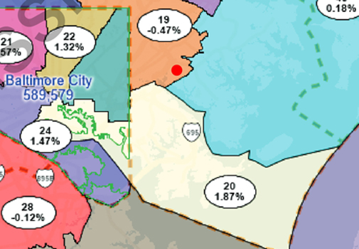
First, the new maps cut the current district in half, connecting the communities from Edgemere and Fort Howard, through Dundalk into the center of Baltimore City in what would be the new district 20.

Next, the maps cut most of the greater Essex Peninsula northward stretching as far as Aberdeen in what would be the new district 43.
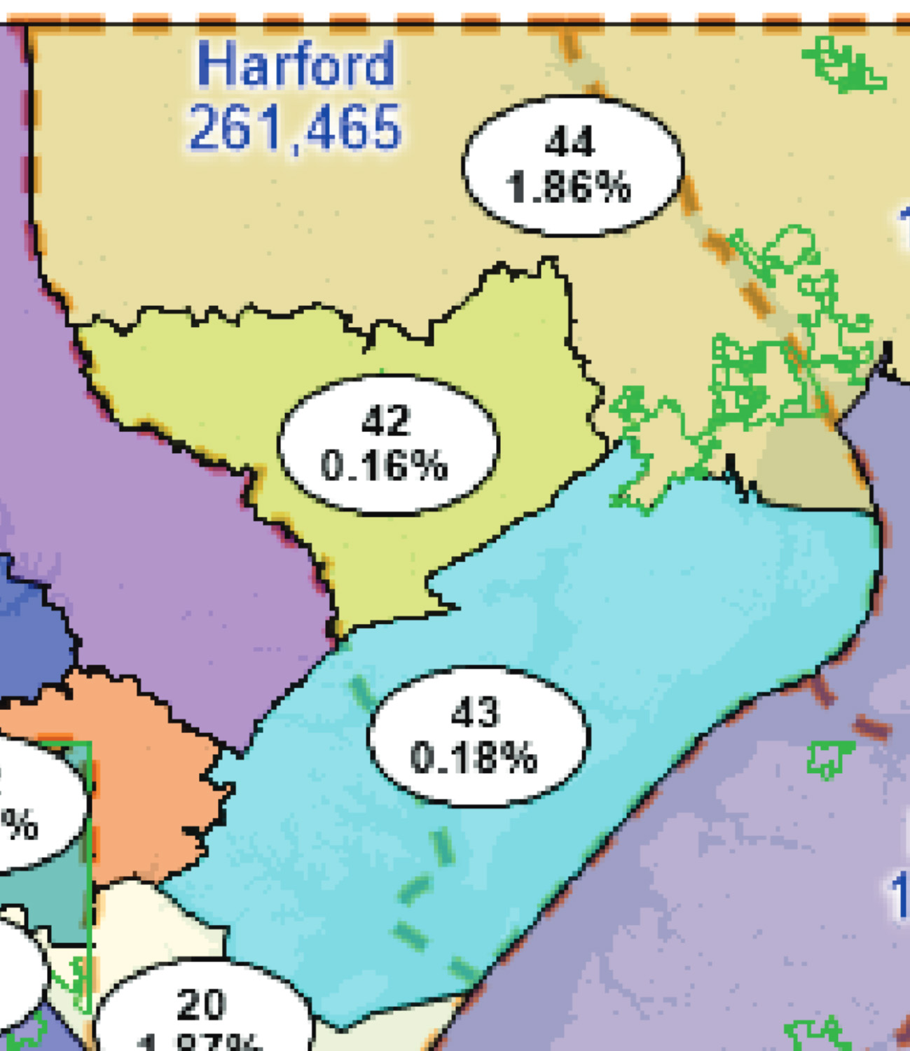
Last, the new maps cut the Essex communities north of Eastern Blvd., (the Backriver Highlands) and connect them with communities up to Parkville and Towson in what would be the new district 19. This map jumps a state highway, railroad tracks and a river to pull northern Essex into a different district.

Among the worst infractions of the maps are the use of eastern Baltimore County as a chopping block for the state.
Case law limits the number of times that a legislative district may cross a political boundary. In practice, political boundaries are only crossed one time to facilitate proper redistricting within the bounds of the law. For example, Baltimore County only crosses into Baltimore City one time (currently on the west side) and crosses into Harford County one time (currently on the northeast side). Although this is not a requirement, the maps may cross a boundary.
Under the current maps, the communities of eastern Baltimore County are split to bear the entire burden of redistricting the entire Baltimore/Harford region.
The residents of eastern Baltimore County are communities of similar interest. When residents of our adjoined communities talk about what makes our communities great, they share the same stories. When residents of our communities speak about our challenges, they share the same stories.
Our communities reflect the diversity of our region, reflect the cultural heritage of generations of families that were born and raised in Baltimore and reflect the legacy of our manufacturing and steel industries.
It would be a terrible shame and injustice to see our communities bifurcated to make whole other areas of the state.
That is why I am reaching out to our communities to ask for your support in keeping our communities together.
I have put together the petition below to help organize an effort to convince the commission to keep the communities of eastern Baltimore County together.
If you sign this petition, it will take you to a page with directions about how you can help convince the commission to keep our communities together.
Will you please help me unite the communities of eastern Baltimore County by signing the petition below?

Delegate Robin Grammer
Comments are closed.